Seeber Loop Trail

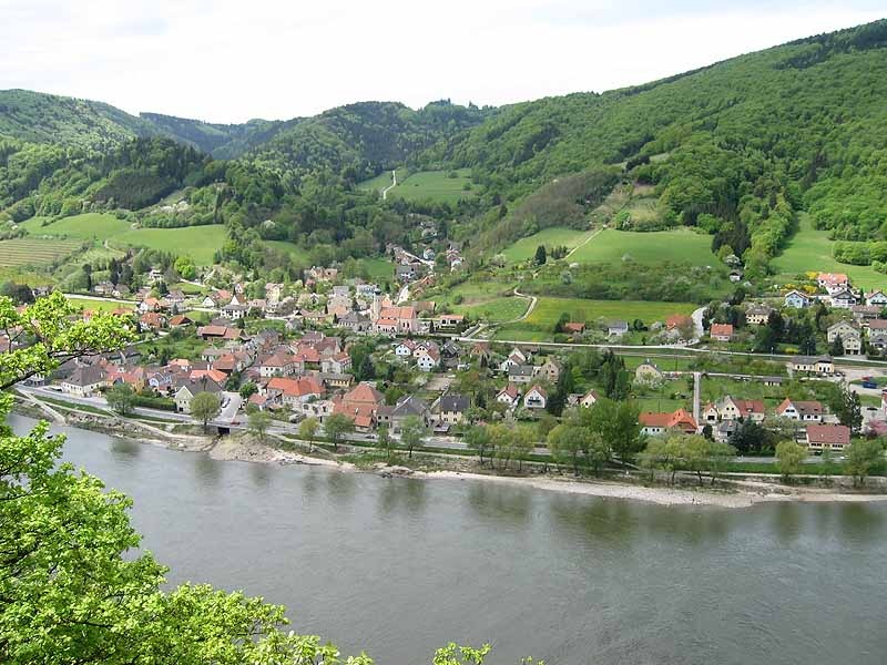
Our almost twelve-kilometre hike takes us from Aggsbach-Markt, the western end of the Wachau wine-growing region, through a loess hollow path into extensive forests (oak-hornbeam, spruce-larch, mixed beech forest). We pass between meadows, fields and Christmas tree plantations in small villages such as Schlaubing, near the Hubhof (a fortified farm dating back to the 12th century) and the hamlet of Seeb, which nestle gently on the slopes of the 960 m high Jauerling (highest mountain on the Danube). From there, we take a wonderful hollow path to "Bireben" and from there back to Aggsbach-Markt with its parish church of the Assumption of the Virgin Mary (a late Romanesque pillar basilica from the 13th century) and back to the market square. The hiking trail (No. 20) is uniformly signposted throughout with yellow signs.
Our almost twelve-kilometre hike takes us from Aggsbach-Markt, the western end of the Wachau wine-growing region, through a loess hollow path into extensive forests (oak-hornbeam, spruce-larch, mixed beech forest). We pass between meadows, fields and Christmas tree plantations in small villages such as Schlaubing, near the Hubhof (a fortified farm dating back to the 12th century) and the hamlet of Seeb, which nestle gently on the slopes of the 960 m high Jauerling (highest mountain on the Danube). From there, we take a wonderful hollow path to "Bireben" and from there back to Aggsbach-Markt with its parish church of the Assumption of the Virgin Mary (a late Romanesque pillar basilica from the 13th century) and back to the market square. The hiking trail (No. 20) is uniformly signposted throughout with yellow signs.
Wachau Mountain Rescue Emergency Number: 140
Hiking boots, rain gear, drinking water, and the "Welterbesteig Wachau - Wachau World Heritage Trail" hiking map are available from Donau Niederösterreich Tourismus, www.wachau.at
From the market square, we turn left, then right in front of the Kurz family’s wine tavern and pass the kindergarten, then go straight ahead twice, crossing the Wachaubahn railroad tracks. After 20 m, turn left, and after 150 m, turn right. Soon, the paved road turns into a beautiful forest path. Now the trail leads uphill through a loess ravine, and we cross a forest road (follow the Welterbesteig Wachau - Wachau World Heritage Trail). We continue straight ahead twice more until we soon reach a clearing, where, after a left turn, we come to the intersection with the “Edelbergrunde” (349 m). We take the left path uphill, keep to the right at the large clearing, and follow a beautiful forest path through a spruce-larch forest. Soon the forest road turns into an asphalt road, which we follow to the right via Bärenreut (506 m) until it ends. There we reach a country road.
After a short downhill stretch, we turn right and eventually cross the Zintringer Brückerl. Immediately afterward, we turn right and, after 30 m, turn left again onto a quiet forest path. Hiking gently uphill, we pass through a mixed beech forest and a spruce forest, crossing the “Krumme Hand,” and then continue between meadows, fields, and Christmas tree plantations to the hamlet of Schlaubing, where we follow the road to the right in the center of the village, then continue straight ahead for a short distance, and soon after a right-hand curve, cross the Seeber Bacherl. At the next intersection, we continue straight ahead onto the Seeb farm road. At the next intersection, we continue straight ahead, passing the “Seeber Marterl” (on our right). After about 150 m, the dirt road branches off to the right onto a meadow path, which, in a right-hand curve, merges back into an idyllic sunken path. We follow the Jauerling Loop downhill, which after 30 m turns right onto a smaller forest path. The sunken path leads through a clearing and shortly thereafter back into another one. Spring flowers, butterflies, lizards, and slow worms enrich our experience of nature. At the next intersection, we continue straight ahead downhill through a mixed beech forest, where we can spot a wayside shrine on the left side of the path featuring the Virgin Mary and Child. Here is a spring protection area with a small water house.
Continue straight ahead on the trail until a small path branches off to the left. Shortly afterward, we reach the “Bireben” intersection (332 m) with a view of the Danube, Aggsbach-Markt, and Aggsbach-Dorf. Here, we turn right onto the small paved road and follow it to its end. At Villa Westend, we turn left and follow the Endlingbach stream, which flows to our right. Soon we pass the parish church and the elementary school. Shortly afterward, we pass under the Wachau Railway and return to the market square.
Market Square, Train Station, Venus Hall
Take the A1 to Melk and then the B3 to Aggsbach-Markt, or take the S5 or S33 to Krems and then the B3 to Aggsbach-Markt.
Take the Wachaubahn train from Emmersdorf or Krems to Aggsbach Markt: www.wachaubahn.at.
Aggsbach Markt can be reached hourly via bus line 715 from the Melk and Krems train stations; for schedules, visit www.vor.at.
There is a Nextbike bike-sharing station in Aggsbach Markt. For more information, call 02742/22-9901 or visit www.nextbike.at.
Recommendation: Restaurant Genussterrasse in Aggsbach Markt is a popular restaurant right on the banks of the Danube that serves home-style, seasonal, and regional dishes on its sunny terrace, offering a magnificent view of the Danube and the Aggstein Castle ruins. www.restaurant-genussterrasse.at
The Venusium Museum in Willendorf—a small but delightful gateway to the world of the Stone Age and the famous Venus of Willendorf, www.willendorf.info
Leider können wir Ihnen zum jetzigen Zeitpunkt keine Wetterdaten für den Ort anzeigen.
Person responsible for the content of this tour:
Wachau-Nibelungengau-Krems Valley ("Kremstal" in German):
Letzte Änderung: 3 Aug 2026
